Great Game heritage

On my second day in Kashgar I discover, to my surprise, that behind the brutal concrete hotel in which I stay, the old British consulate is fully preserved though stripped of its famous garden.

The British interpreter, later diplomat George Macartney arrived in Kashgar on expedition in 1890 and soon became the first British consul here. He was to stay until 1918 as a major player in The Great Game – the struggle between empires for ultimate control of the roof of the world in Central Asia.

Macartney married Catherine Borland in 1898 and together they managed the British general consulate in Kashgar – the Qini bagh – which was a grand house with beautiful gardens famous for their views over the mountain ranges in the south.

16
The Qini bagh

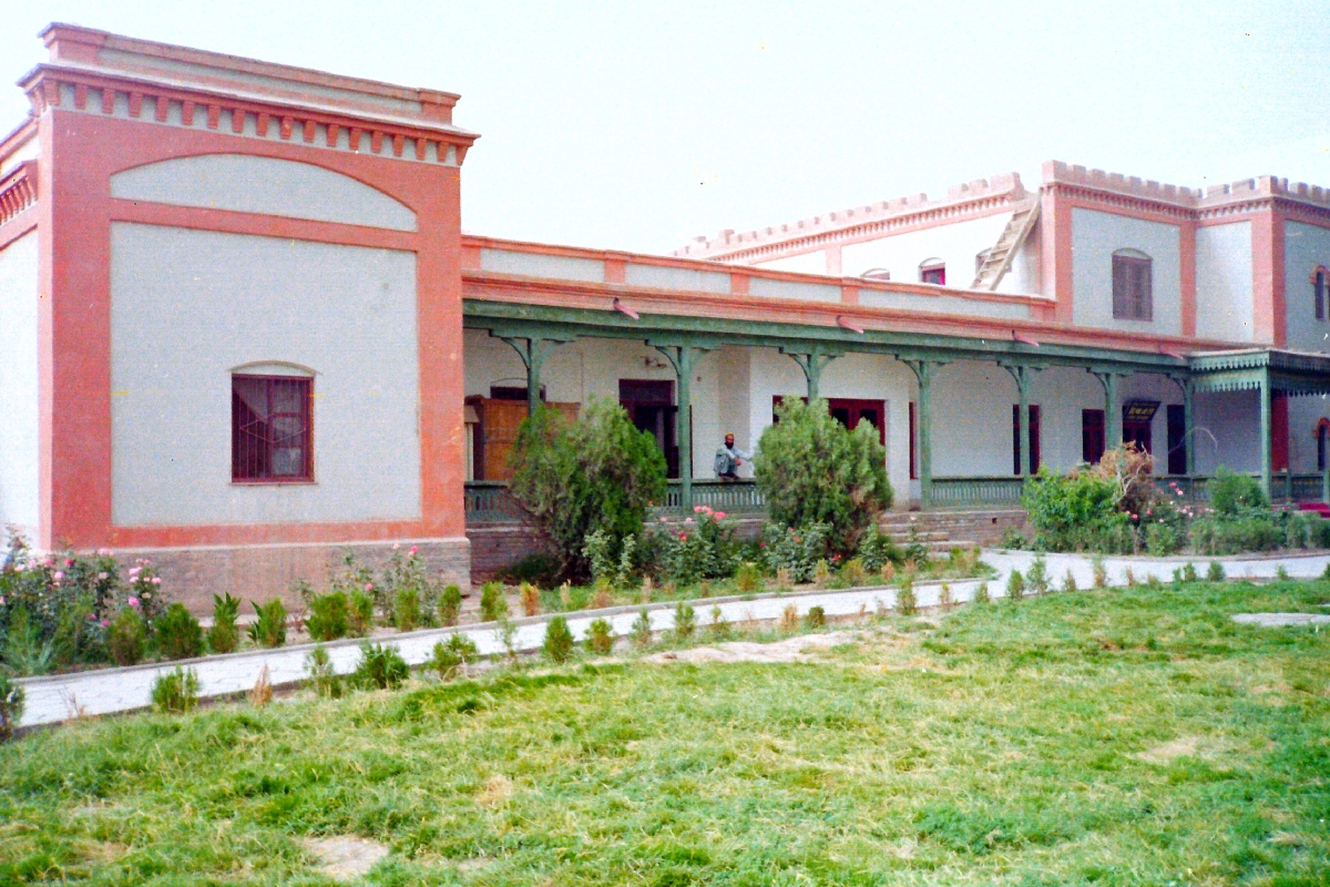
Diplomats, spies, explorers and archaeologists investigating the ruins of the Taklamakan desert all stayed at Qini bagh and most famously archaeologist Marc Aurel Stein, who often recuperated here after desert expeditions.

Russia, the main British counterpart in The Great Game, already had a consulate in Kashgar when Macartney arrived.

Though Kashgar was formally a Chinese city in the 1890s, the most powerful man there was the Russian consul Nikolai Petrovsky who kept a military garrison on the consulate.

When the Swedish explorer (and rival of Aurel Stein) Sven Hedin arrived in Kashgar in 1894 he was greeted by Petrovsky with free vodka and Hedin stayed several times here, receiving all kinds of support from Petrovsky in his desert explorations.

17
Previous Russian consulate in Kashgar

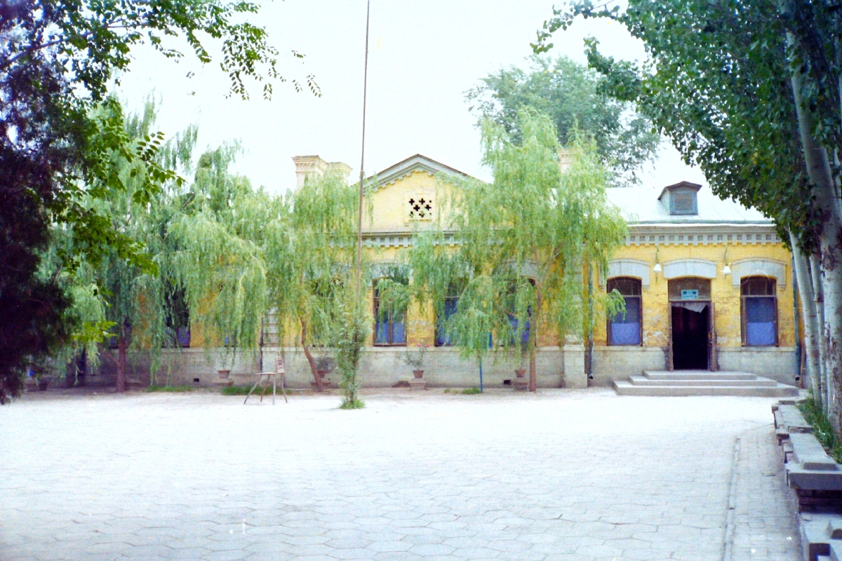
I find that the cheapest rooms of the Seman hotel in Kashgar are actually inside what was previously the Russian consulate, so for my second night I reside there.

It’s not well kept but strolling around the house I manage to enter the dining hall, where Petrovsky held banquets for diplomats, explorers and Chinese dignitaries a hundred years ago.

The old consulate houses remain in Kashgar as memorials to the clash of empires on the roof of the world and to the strange age of imperial explorers stripping the amazing ruins of Silk Road cities in the Taklamakan of antiquities to bring home to European museums, which is another story.

18
Dining hall of the previous Russian consulate


Kashgar, Silk Road Oasis

Uggla final
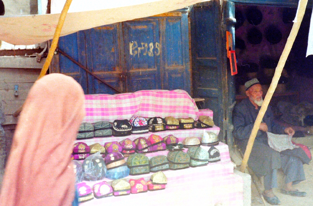
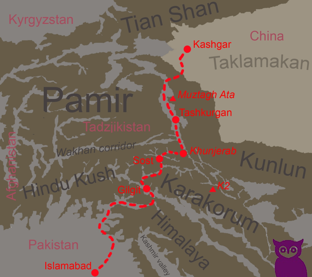
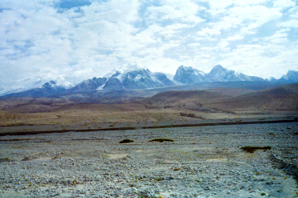
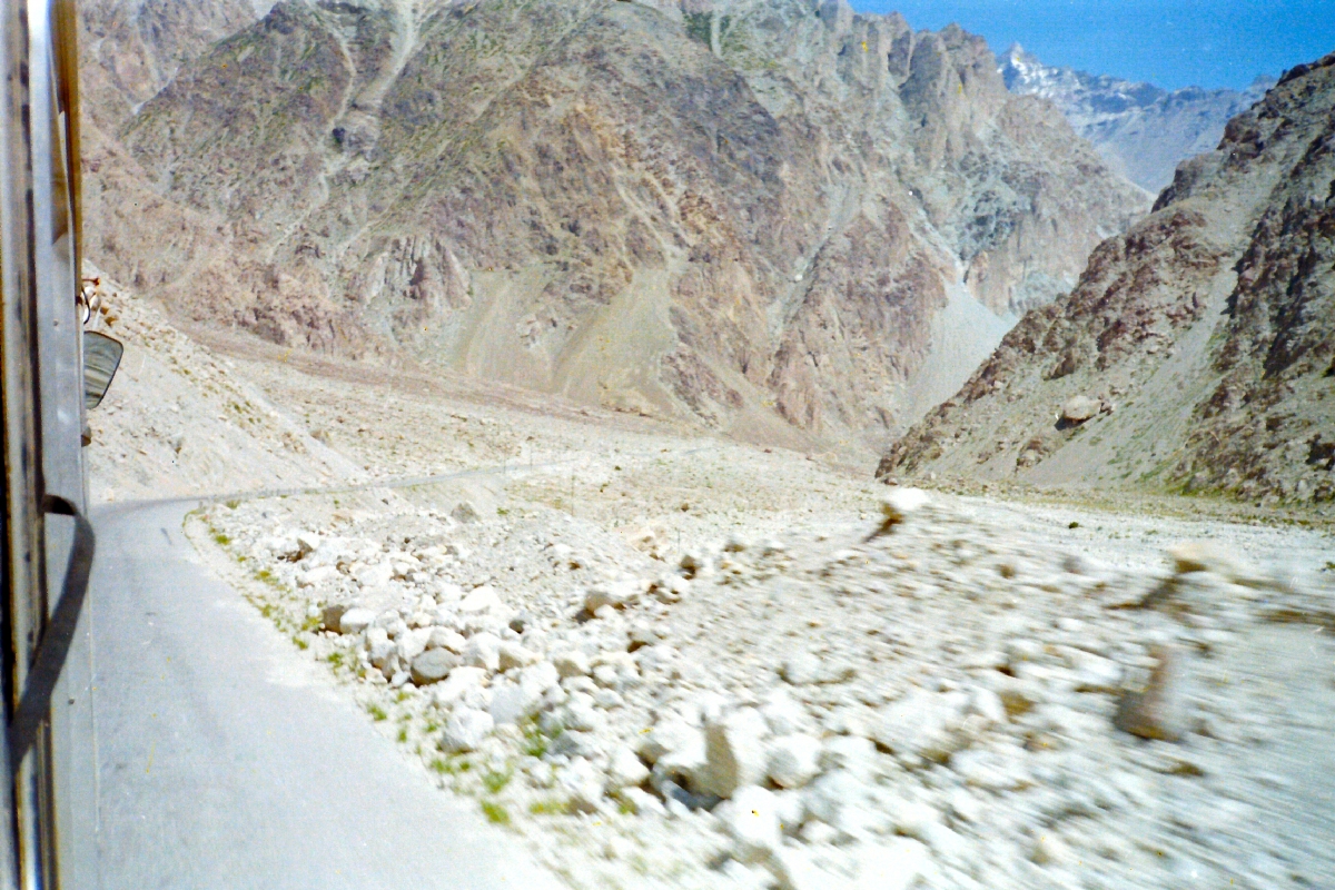
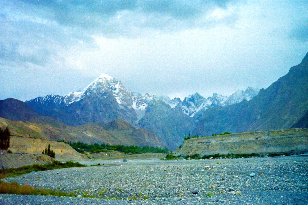
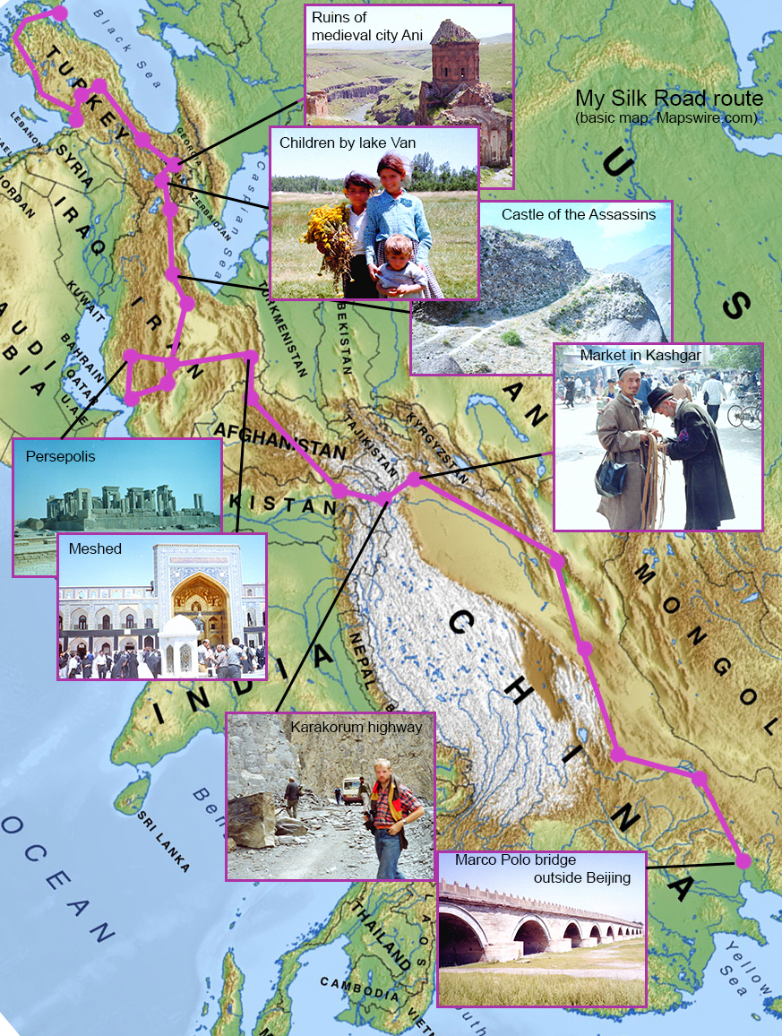
We are at the end of the Karakoram Highway, on the rim of the Taklamakan desert and in the great city of Kashgar, a regional center for the western part of the Chinese Xinjiang province, an oasis on the Silk Road and historically a small, independent kingdom of its own.

Few foreigners visit Kashgar today due to current tensions between official China and its Muslim Uyghur minority here which have been covered in international media and was commented on, for example, by Anne Applebaum in The Washington Post in February.

Current events are the latest phase of a long history of independence movements, repression and terrorism during the 20th century – though my own impressions going here 20 odd years ago were mostly of other things.

This is the fifth in a series of blog posts relating a passage along the Karakoram Highway. Read the previous ones here, here, here and here.

15
On the square outside the Id Kah Mosque (right) in Kashgar

Having left Tashkurgan on a bright summers morning I reached Kashgar by bus going through the eastern Pamir mountains and then by the rim of the Taklamakan desert.

Kashgar is an oasis city, surrounded by vast stretches of poplar trees and it’s been a crucial waypoint on the Silk Road forever. You either got here after a hard trip over the Himalayas or after the deadly journey across the Taklamakan.

The city is flat, with straight, wide boulevards lined with poplars and dusty with desert sand. There’s little left of old Kashgar since it has been bulldozed to make way for modernity. A few blocks of “old town” are seen within minutes. On my first day I walk up to the main historical landmark, the striking, yellow-tiled, AD 1442 Id Kah Mosque, the largest in China, of great symbolic value and a site of major events in the past.

19
Uyghur “Doppa” hats on sale

The Tarim Basin, which is the largest part of present Xinjiang province and which mainly consist of the Taklamakan desert, is a true crossroads of history.

In the early centuries AD, there was a line of small, independent oasis kingdoms here along the Silk Road routes north and south of the desert. Kashgar in the far west was one of them. This is while direct Chinese control ended behind the Jade gate of the Great Wall, to the east of the Taklamakan.

Tang dynasty Chinese rulers tried to conquer the Tarim Basin with temporal success. Later on, the entire area fell to Muslim, Turkic peoples in the 11th century and the following 1 000 years was a complex tapestry of struggles between different powers. Xinjiang was set up as a regular Chinese province in the late 19th century.

The 1930s and 40s saw failed rebellions aimed at establishing an independent “eastern Turkestan” state. In 1933 the head of the executed Uyghur leader Timur Beg was put on a spike outside the Id Kah Mosque. 

I explore the city on a rented “Flying Pidgeon” bike and I soon get the idea to bicycle out to the edge of town to see the desert. Going for hours on an endless poplar-lined avenue seems to take me nowhere and I am forced to give up, hitching a truck ride back.

21
On the outskirts of Kashgar

So Kashgar is mainly a Muslim city, but Islam looks quite different here from in Pakistan and Afghanistan which I just came from. Women are seen everywhere and are seldom as veiled as further south. There is also nightlife here with bars selling liquor.

Another main difference is language. No one speak English and I don’t understand the signs in Chinese, which builds up a huge cultural barrier.

The Great Bazaar of Kashgar is one of the largest in Asia. It’s a maze of small stores and gives you a glimpse of past Silk Road glories.

On my second day, I suddenly discover the famous old British consulate building is actually preserved just behind the huge concrete block in which I stay. The Qini bagh was a major hub in the Great Game – the late 19th century powerplay of empires on the roof of the world, and I can’t wait to explore it.

Route

The Stone Tower

Ancient sources about the Silk Road mention a mysterious place, “The Stone tower”, which was a midpoint between China and the far West and located in the most remote mountain areas of Central Asia.

The Stone tower was a crucial way-point and a place for caravans to rest and store provisions for the long journey, but where was it?

Geographers, historians and early explorers debated the true location of this Stone tower, which is an important historical place for sure. One of the best candidates is Tashkurgan in the west Xinjiang region of present China – a town high up in the Pamir and one of the most remote places on earth. I got there by crossing the Himalayas from the south on the Karakoram Highway.

This is the third in a series of blog posts relating a passage along the Karakoram Highway. Read the first and second one here and here.

Var nånstans
Arriving in Tashkurgan

After crossing the world’s highest border, between Pakistan and China in the Khunjerab pass, I change to a Chinese bus continuing on the Karakoram Highway. We soon enter the Tashkurgan valley, following the Tashkurgan River northwards and reach the regional capital city of Tashkurgan after just a few hours’ drive.

8
Tashkurgan valley, with the eastern Pamirs in the background

The name of the city literally means Stone tower. It is flat, earth-colored and full of poplar trees and signs in Chinese that I don’t understand. I am tired beyond belief and crash in the filthiest little cheap hostel you ever saw, the “Pamir”. Some of the floorboards are missing in my dormitory.

We are now in Xinjiang, the westernmost region of present China which is dominated by the great Taklamakan desert and historically a periphery with small kingdoms just outside the main Chinese sphere of power. One of its many minorities, the 40 000 or so strong Mountain Tajiks live here in an autonomous region with Tashkurgan as centre.

The Mountain Tajiks are generally Shia Muslims and speak an eastern Iranian language. Their religious practices are allowed but very restricted.

Route

Tashkurgan has got its name from a large, old fortress sitting on a high hill at the outskirts of the present town. The ruins were off-limits at my visit, unfortunately, but images of it appear directly if you search the web for it. The river valley is otherwise flat and the lone, marked hill with the castle on it must have looked very much like a mighty “Stone tower” to caravans passing here in the old days. And it’s visible for miles.

The place is significant as way-point since this is a last outpost in many ways, At Tashkurgan the Silk Road caravans from China had to make a choice if they were headed south across the Karakoram for the subcontinent or west through the Wakhan corridor of Pamir to present north Afghanistan and the great Silk Road cities there.

Where the Stone tower of ancient sources was really located is probably an unsolvable historical mystery, but a number of factors clearly speak for Tashkurgan.

7
In Tashkurgan

I leave Tashkurgan on an early morning bus northwards to Kashgar, the oasis town on the rim of the great Taklamakan desert. The Tashkurgan valley is wide, fertile and with small villages and wandering camels and jaks. Here and there are a few Tajik yurts.

The air is supremely clear and the light very sharp. After about two hours on this comparably well kept and paved stretch of the Karakoram Highway we reach the delicately beautiful, blue-grey and perfectly still Kalakule Lake. But above the calm lake towers an untamed giant, notoriously unpredictable.

12
On the bus from Tashkurgan to Kashgar

On top of the world

Uggla finalThe Karakoram highway between Pakistan and China was cut out of the Himalayan mountainsides and stretches some 1 300 km from the rich Punjabi plains in the south to the ancient Silk Road town of Kashgar in the Taklamakan desert to the north.

On top of the world is the first of a series of blog posts relating a passage along the Karakoram highway.

A trip on this road is a journey of a lifetime and may be the most scenic and adventurous one you can do anywhere. It takes you right through the greatest crossroads of the world. This is where the grand mountain ranges meet, where the prime historical empires clashed, where peoples and religions mixed and where fortunes were made on the Silk Road.

Travelling “the roof of the world” in the Pamir area is a physical and poetic experience as well. The human condition seems frail indeed when shadowed by giant mountains.

Route

To me, it all started in the south. I got to a rainy Peshawar by plane, all shook up after some days living with the Mujahedin in Afghanistan while following in the steps of Marco Polo.

I knew I wanted to go over the mountains to Kashgar on the legendary Karakoram highway but soon found out I had to do it in stages. I boarded a minibus for Gilgit in Islamabad in the morning and took of across the lush, damp and fertile plains.

1
Rains in Peshawar

The bus soon passes by the ruins of Taxila, ancient capital of the Indus valley and conquered by Iranian empires and Alexander the Great. Taxila is UNESCO world heritage and worth stopping at if you’ve got the time.

After a while the road follows along the Indus itself, the source of all historical wealth here. The mighty river has its sources high up in the Himalayas and its grand scale brings a hint of what is to come.

Abbottabad is white, flat and well-ordered, I can see from the bus. Signs saying ”Officers mess” and ”Soldiers hospital” fly by. Everything is more British here than in England.

The landscape gets steadily more rocky and the road steadily worse as the hours pass. Late at night we must stop since the road is blocked by a landslide and I lie down to sleep with my backpack on the roof of the bus. In the early morning we march in column over the landslide and board another minibus on the far side.

High up in the Himalayan valleys now, still following the Indus, the mountains get higher and higher and the road truly frightful. There are minor landslides and large single rocks all over the driveway. The road often narrows down to a slim rock shelf over terrifying abysses. We constantly meet colourful Pakistani trucks for chicken-races.

In the afternoon we reach Gilgit. It’s a grey and gloomy place and a trekker’s paradise with small shops, hotels and restaurants serving banana pancakes. The Great Game may have been played here but that doesn’t make it much funnier.

Over the tiny assemblage of houses by the river the row of immense, dark peaks of the Karakoram towers in the north-east like a line of giants with snow-white crowns and immediately takes my breath away.

2

The Silk Road with Marco Polo

Uggla finalHave you thought about travelling the Silk Road, the legendary network of overland routes from the Mediterranean to eastern China?

You should, and there is no better guide than Marco Polo, the venetian who was the first westerner to do this journey describing what he saw. When Marco travelled from Venice to Beijing 700 years ago it was like going to the dark side of the moon.

Spellbound by Marco Polos book and its mysteries I followed in his steps some years ago. Who were the strange Assassins sect he writes about, or those worshipping an eternal fire in present Iran? What roads did Marco actually take and could they be travelled again? How could he even do this trip in medieval times without modern equipment? The Mongols, occupying most of Asia, were seen as the legions from hell by Christian Europe, so how did Marco dare to engage with them?

Physical Map of Asia

The Silk Road

The so-called Silk Road is a network of roads rather than a single route, leading from eastern China over land to the Mediterranian sea in the west. By Marco Polos time they had been travelled by traders and caravans for more than a thousand years already, but very few people travelled all the way. Trade was mostly done back and forth over parts of the network of routes and between great cities such as the silk centres of China and Kashgar, Bokhara, Samarkand, Balkh, Herat, Merv, Tabriz, Bhagdad and Istanbul. The historical importance of these routes is immense. Empires thrived controlling them and fell to armies following them.

Going all the way today you might want to start in Istanbul and end up in Beijing, like I did, going through Turkey, Iran and then either Afghanistan and Pakistan or through the central Asian former Soviet republics and finally across China. It’s a 4 000 miles / 7000 km journey as the crow flies, much longer on the ground.

Venedig x

A tricky route

The “oveland trip” from Europe to India was popular during the 1960s and 70s and more or less for anyone though mostly attracting young people, many of which were “hippies” in search of alternative lifeways and seduced by Asian religions or philosophies. The hippie trail eastwards came to an abrupt end though, precisely in 1979 and due to political upheavels. The soviets invaded Afghanistan this year and a religious movement dethroned the Shah of Iran, creating an Islamic republic.

Since then there have been wars in Afghanistan and from time to time impossible to pass through Iran. Travelling the Silk Road today is tricky for the long and arduous road itself. You are, after all, journeying a considerable part of the globe and having to handle the bureacracy of the many countries you will have to pass is a trick in itself.

Yazd x

In a way, Marco Polo had it easier. The Mongols may have been feared by the Christian leaders of Europe, but for smooth traders like Marco and his elder venetian relatives they were no difficulty. The same Mongol empire ruling most of the Silk Road area rather made things easier once the Polos had befriended the great khan. The Polo family even acted as ambassadors for the khan of the Mongols to the Pope, and vice versa, representing the Pope at the court of the khan.

Following Marco Polo

The curious thing about Marco Polo and his book are its many riddles which have kept historians and adventurers going for a long time. Marco recorded his route and his impressions of countries and cities, but he also recorded the many stories and legends told to him along the way. I had the opportunity to investigate some of them, which I will return to.

I followed Marco Polos Silk Road route through Turkey, visiting the lost city of Ayas, spent three weeks tracing his roads in Iran which turned out a very hospitable country to me and where I managed to see Shiraz, Persepolis and the holy city of Meshed. In Afghanistan I stayed with a mujahedin guerilla fraction in Herat before flying to Pakistan and going by the ruff Karakorum highway across the Himalayas to Kashgar in the Taklamakan desert area of western China. I visited the famous Dunhuang caves by the desert and rode steam trains through northern China to Beijing.

Herat x

Kashgar x